
Wood Chart Lake St Clair
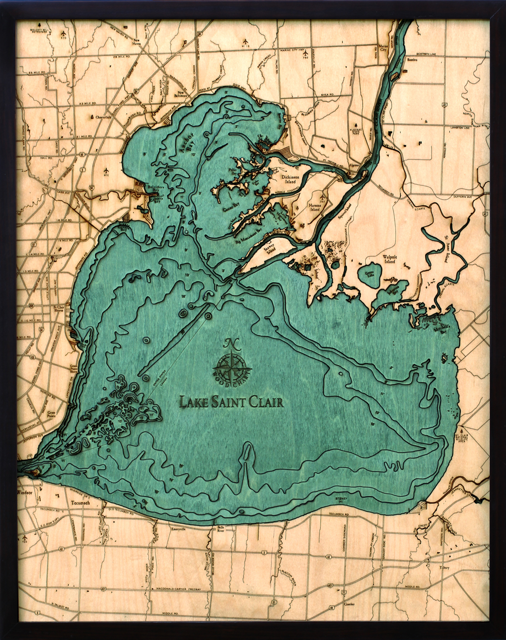

Wood Chart Lake St Clair
Wood Chart Lake St Clair.
Starting with a bathymetric chart (the underwater equivalent of a topographic map), The Great Lakes Maps are laser-cut to carve the contours into sheets of Baltic birch. The layers are glued together to create a powerful visual depth. Select layers are hand stained blue so it’s easy to discern land from water, etch major byways into the land, then it is framed in a custom, solid-wood frame and protected with a sheet of durable, ultra-transparent Plexiglas.
Other maps are available based on the scenic Pacific Northwest’s volcanic coastline, the warm sandy shores of the Southwest and Southeast, the history-rich coastline of the Atlantic, and lakes from all around the continent.
Size: 31 * 25″
Related Posts
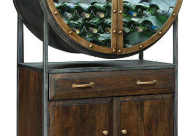
Porthole Wine Bar
Porthole Wine Bar features heavy, rivet style metal doors, mirrored back, wine rack storage, two…
Mid Century Wine Bar Cabinet
Mid Century wine bar cabinet features unique, stream-lined style with it's splayed metal legs, mirrored…